The lake
What Mountain Island Lake actually is
A narrow, hard-working stretch of the Catawba River that happens to be one of the most protected bodies of water in North Carolina.
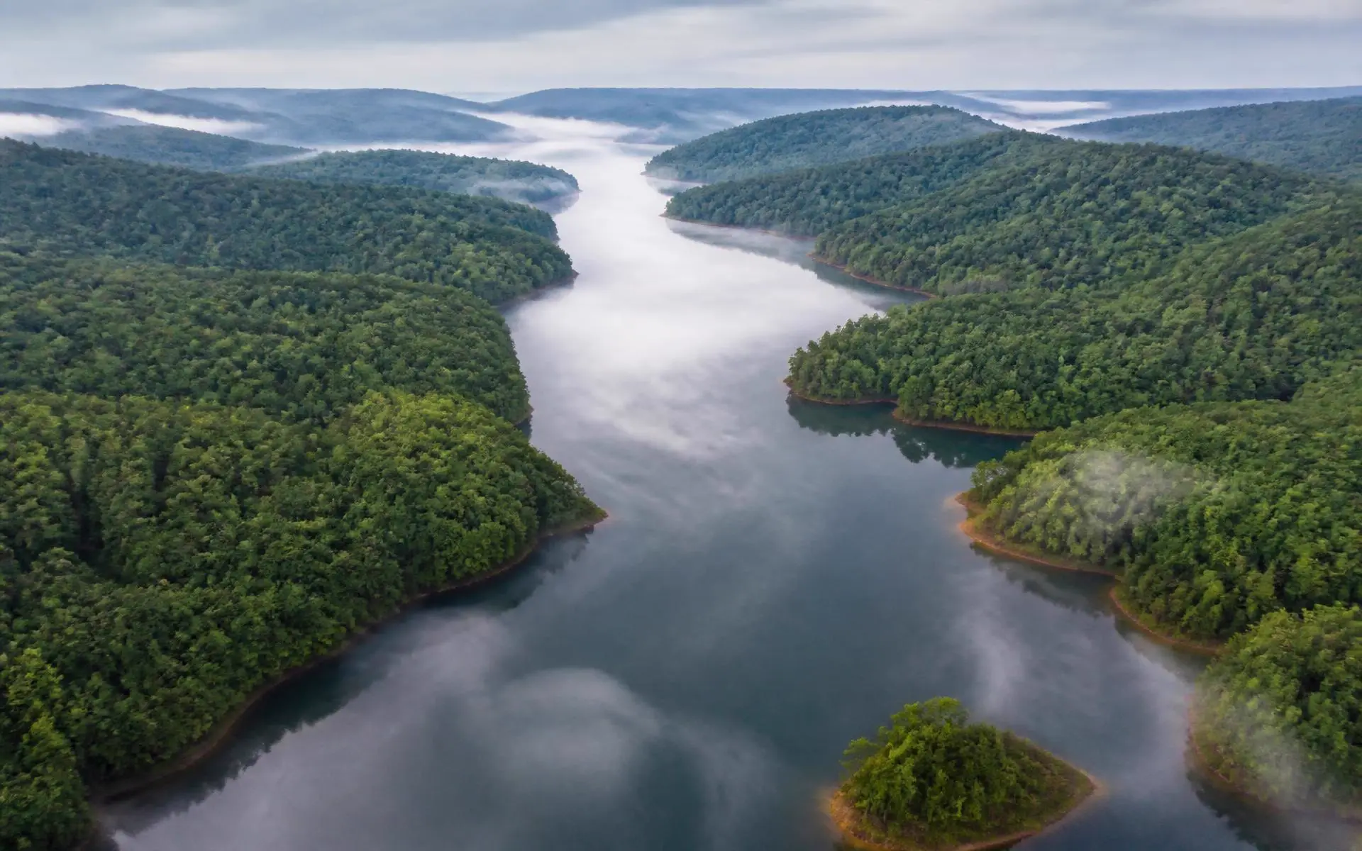
Mountain Island Lake is the middle child of the Catawba River chain around Charlotte. Lake Norman sits upstream and holds more than 32,000 acres. Lake Wylie sits downstream with roughly 12,000. Between them, Mountain Island Lake covers about 3,281 acres — small enough that you can cross it in a few minutes and long enough, at roughly fourteen river miles, that it never feels used up.
The shape matters more than the size. This is a riverine reservoir: a drowned river valley rather than a flooded basin. The main channel runs like a wide green corridor, with coves branching off into hardwood bottomland. Fetch is short, so wind rarely builds real chop. On most mornings the water is glass.
The numbers
Mountain Island Lake at a glance
- Surface area
- Approximately 3,281 acres
- Shoreline
- Approximately 61 miles
- Length
- Roughly 14 miles along the Catawba River channel
- Full pond elevation
- Approximately 647.5 feet above mean sea level
- Created
- 1923, by completion of the Mountain Island hydroelectric dam
- Operator
- Duke Energy, under federal license
- Primary purpose
- Hydroelectric generation and public drinking-water supply
- Counties
- Mecklenburg (east), Gaston (west/south), Lincoln (north)
- Upstream / downstream
- Lake Norman above; Lake Wylie below
Why the water level barely moves
Owners coming from other Southeastern lakes are often surprised by how stable the shoreline is. Mountain Island is a run-of-river reservoir operated primarily to pass water through — and because Charlotte Water draws its supply here, drawdowns of the kind that strand docks on storage lakes are not part of normal operation. Levels fluctuate within a narrow band, which is why fixed docks are common and why shoreline landscaping survives.
Three counties, one lake
The lake touches Mecklenburg, Gaston, and Lincoln counties. That is not trivia; it is the most consequential fact for anyone buying here. Two homes three hundred yards apart across the water can sit in different school districts, pay materially different tax rates, and answer to different permitting offices. Always confirm the county for a specific parcel before comparing anything.
See communities shore by shore, school assignment by district, and what to verify on a waterfront lot.
Who governs what
The water and the land immediately around it fall under overlapping authority. Duke Energy manages the project boundary — docks, piers, stabilization, and vegetation within it. Charlotte Water operates the intake and protects source quality. The counties and municipalities handle zoning, building permits, and watershed overlay enforcement. The NC Wildlife Resources Commission regulates boating and fishing. In practice, most owner questions route to Duke Energy first.
Access
Public access is deliberately limited. There is no marina row, no commercial waterfront strip, and no large public swimming beach. What exists is a small set of ramps and paddle launches, plus preserve access on the Mecklenburg peninsula. For most residents, access means a private dock or a neighborhood slip — which is exactly why the lake stays as quiet as it does.
Details on ramps, no-wake rules, and permits are in the boating guide.
- Dam completed
- 1923
- One of the earliest Catawba hydro projects.
- People served
- ~1M
- The lake supplies drinking water to the Charlotte region.
- Preserve acres
- 1,460
- Latta Nature Preserve alone, on the east peninsula.
- Full pond
- 647.5'
- Feet above mean sea level, held within a narrow band.
The map
The lake, point by point
Mountain Island Lake runs about 14 miles down the Catawba between Lake Norman and Lake Wylie, touching three counties. Select a marker to see what sits there.
Parks & preserves
Latta Nature Preserve
1,460 protected acres on a peninsula: trails, equestrian center, and paddle access.
Answers
Questions & Answers
- How big is Mountain Island Lake?
- Mountain Island Lake covers roughly 3,281 acres with about 61 miles of shoreline, making it the smallest of the three Catawba River reservoirs around Charlotte — far smaller than Lake Norman upstream and Lake Wylie downstream. Its modest size is the single biggest reason the water stays calm and the boat traffic stays light.
- Source: Duke Energy — Mountain Island Lake lake services and shoreline management
- Who controls the water level on Mountain Island Lake?
- Duke Energy operates the Mountain Island hydroelectric station and manages lake levels under its federal license. Full pond is approximately 647.5 feet above mean sea level, and the lake is generally held within a narrow band year-round because it functions as a drinking-water reservoir rather than a storage lake.
- Source: Duke Energy — Mountain Island Lake lake services and shoreline management
- Is Mountain Island Lake a public lake?
- The water is publicly navigable and open to boating and fishing, but the shoreline is a mix of private residential property, Duke Energy-managed buffer, and protected public land such as Latta Nature Preserve. Public access is through designated ramps and park access points, not across private shoreline.
- Source: Duke Energy — Mountain Island Lake lake services and shoreline management
- Which counties border Mountain Island Lake?
- Three: Mecklenburg County on the east shore, Gaston County on the west and south, and Lincoln County at the northern end. Which county a property sits in determines its tax rate, school assignment, and permitting authority, so verify the county before you compare two similar-looking listings.
- Source: Mecklenburg County Code Enforcement permitting
Keep reading
Continue the guide
Boating on Mountain Island Lake
Public ramps, no-wake reality, dock permits, and the lake's quiet-water culture.
Fishing Mountain Island Lake
Largemouth, spotted bass, catfish, and crappie on a warm-water Catawba reservoir.
Mountain Island Lake Water Quality
Why this reservoir is Charlotte's drinking water — and what that means for owners.
Waterfront Homes on Mountain Island Lake
Dock rights, cove vs. main channel, and waterfront due diligence.
More in The lake
- Dock Permits & Shoreline Rules
- Lake Access: Ramps & Launches
- Mountain Island Lake Facts
- Latta Plantation
- Parks & Nature at Mountain Island Lake
- Latta Nature Preserve
- Kayaking Mountain Island Lake
- Boat Ramps on Mountain Island Lake
- The Catawba River
- Water Level & Full Pond
- Mountain Island Dam & Hydro Station
- Swimming in Mountain Island Lake
- Lucia Access Area
- Water Temperature
- Parks on Mountain Island Lake
- History of Mountain Island Lake